Drone Inspections, Surveying & Mapping
Manual inspections are slow, disruptive, and put people at risk. Drone photography, 3D Matterport tours, and 360° capture make inspections safer and faster — giving your team clear, shareable data to spot issues and act on them right away.

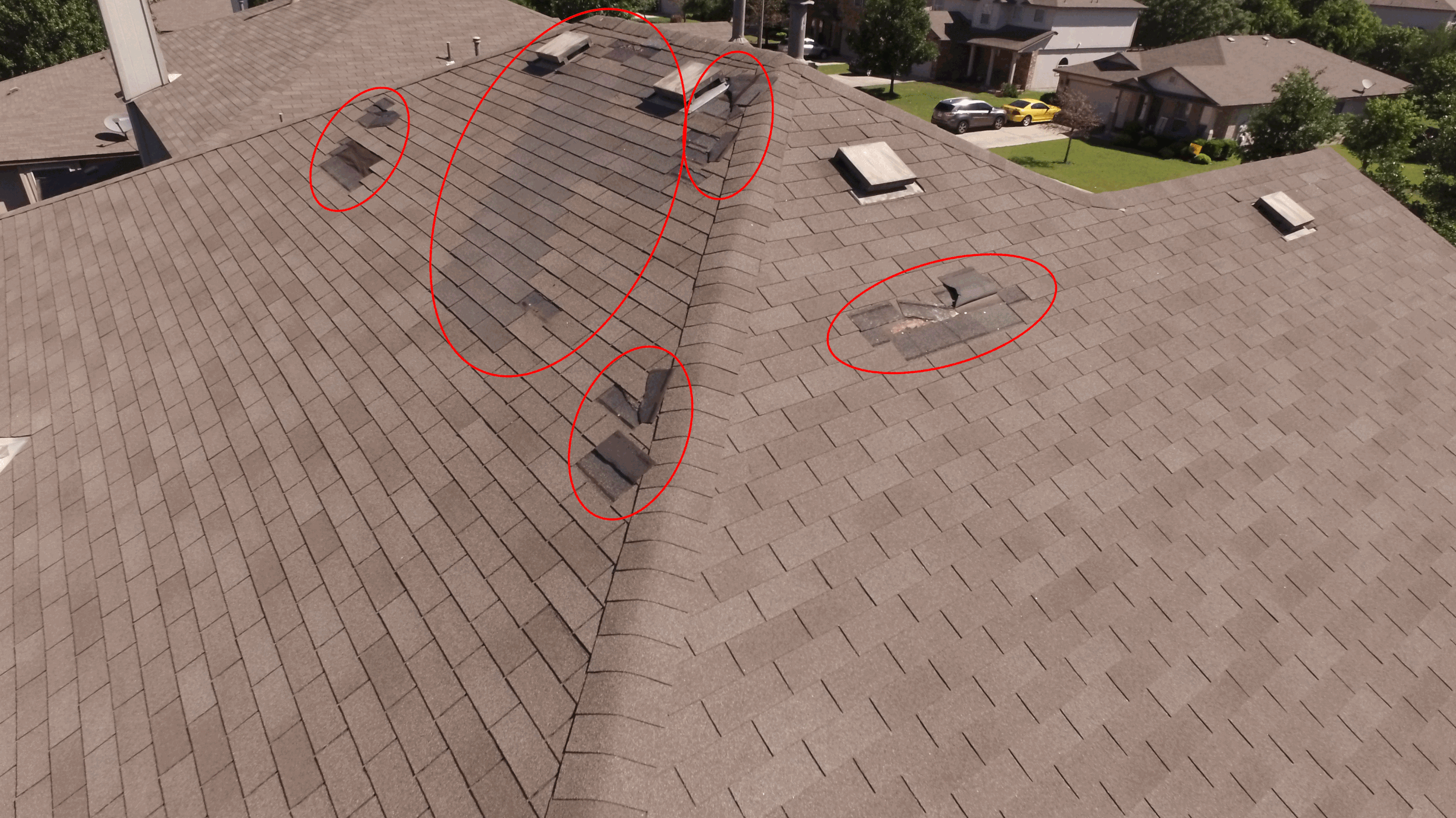
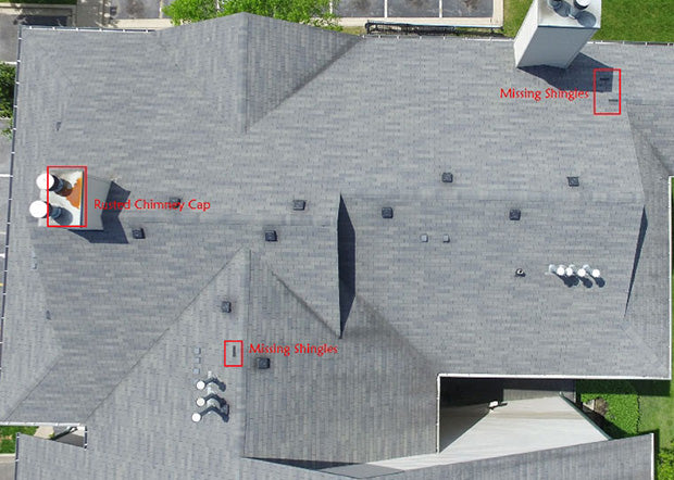
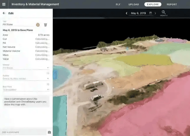
Site and Rooftop Inspections
Use aerial data to safely inspect the progress of site work and perform rooftop inspections for maintenance and repair.
- Automated drone flights allow teams to seamlessly capture data without time consuming and dangerous manual processes.
- Aerial data is automatically processed and transformed into maps and models for teams to remotely measure distances, calculate volumes, and visualize the site in 3D
- Compare to designs and share with project stakeholders to collaborate on inspection results and details using embedded links for individual projects
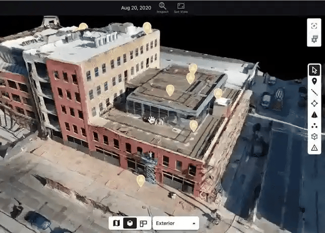
Walkthrough for Interior and Ground Inspections
Easily capture each step of the project to coordinate planning, visualize site progress, and conduct inspections from ground level.
- Frequently walk the interior of buildings, facility yards, and alongside assets for maintenance inspections and documentation of as-built conditions for construction.
- Compare current conditions to maintenance plans, floor plans, and previous walkthroughs for documentation and immediate corrective action and share results with key stakeholders.
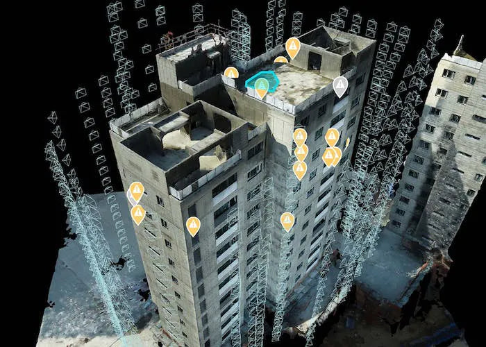
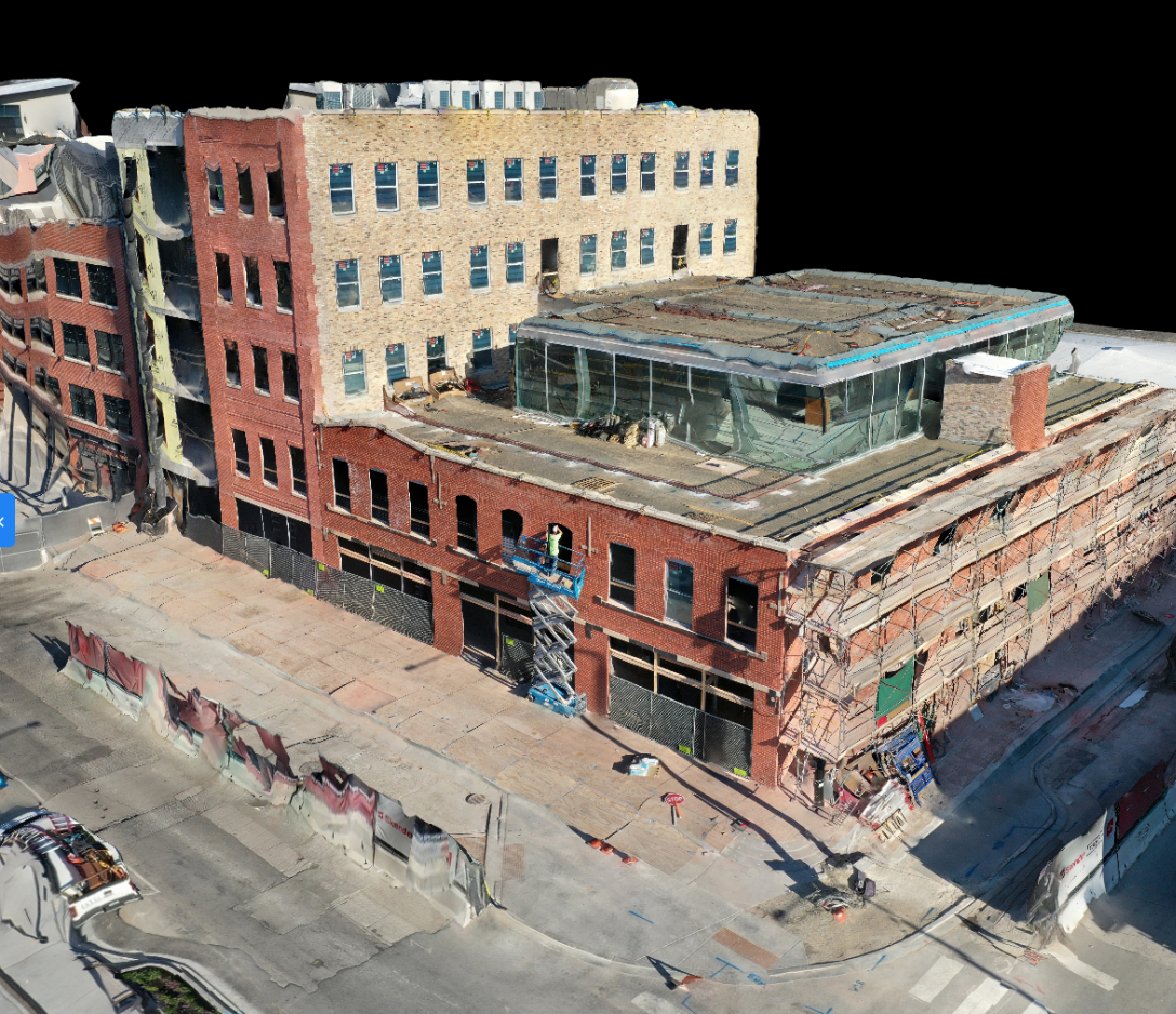
Vertical Flight for Facade and Vertical Structure Inspections
Improve efficiencies and workflows with “automated” drone-based inspections for dangerous and challenging inspections on vertical structures.
- Perform pre-construction inspections with drones and win more bids with high resolution 3D models of existing facade conditions
- Document existing conditions for regular maintenance inspections on structures with high resolution 3D Scans

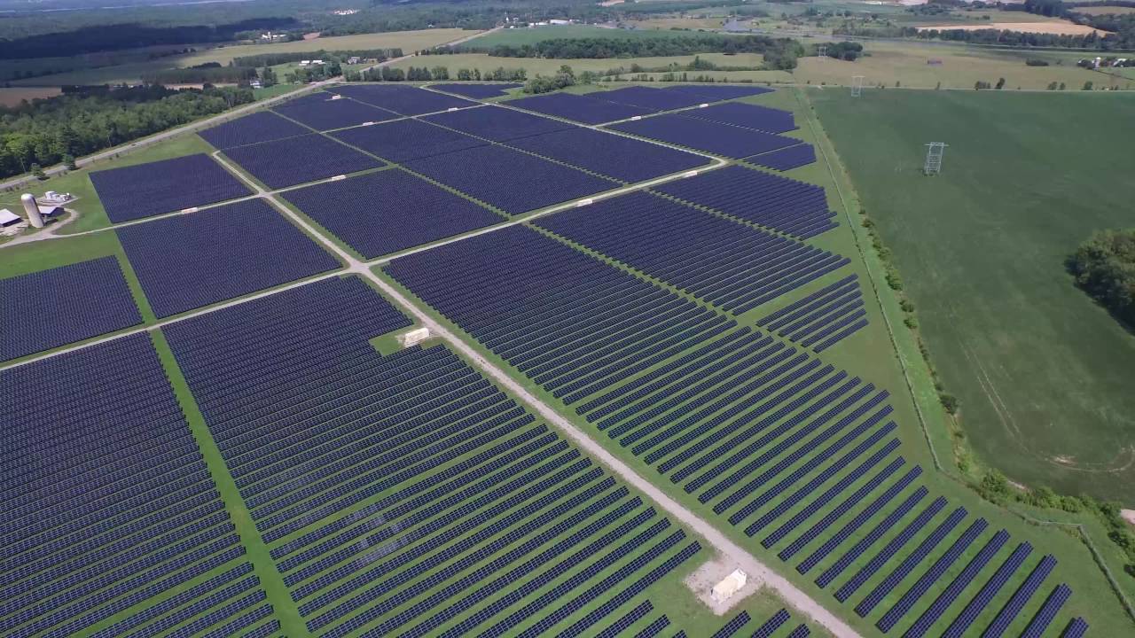
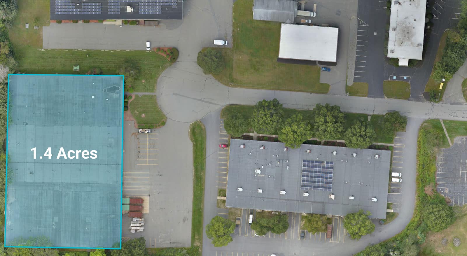
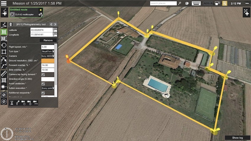
Surveying & Mapping
Get geo-referenced maps, orthomosaics, and real-time project updates. Take measurements straight from aerial imagery and turn land into accurate maps, 3D models, or drawings.
- We can efficiently fly the area over a site in a fraction of the time of conventional methods without substituting accuracy;
- Gives an accurate positioning points on the surface of both man made and natural features;
- Creates a ‘data-rich’ digital asset to provide insight.